My mother died at the end of June 2024, a few months after my father. They lived the last 39 years of their lives in a tidy but full house, surrounded by books, photos, treasures, and memories of travels.
It took a year and a half to transform the house from a cozy den of treasures to the white walls and bare wood I handed over to the new owners last week, and I had a lot of help. Before my parents died, I often wondered how this would go, and worried about it. I was going to want their entire five-bedroom-house’s worth of stuff, and it wasn’t going to fit in my one-bedroom apartment.
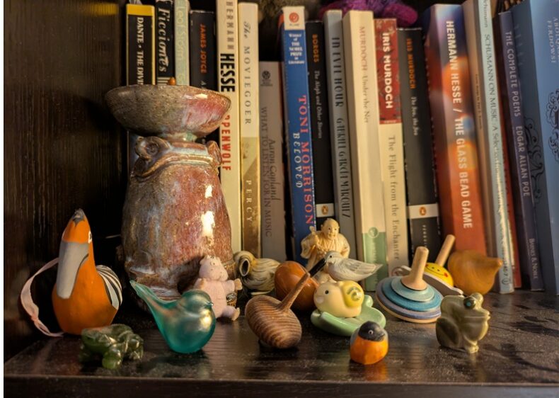
Some of it is here. (Now it’s a two-bedroom house, but it’s not much bigger than the one-bedroom apartment, and it has two people’s stuff in it.) Just above my laptop screen, on a shelf at eye level, are these items from my parents’ house:
- A glass bird
- A ceramic hoopoe ornament, like the hoopoe my mom and I saw in Turkey in 1998
- A tiny bullfinch from Norway
- Two frogs, carved of stone – my dad loved Zuni fetishes, tiny carvings by Zuni artists (one has the artist’s name on a sticker on the bottom)
- A purple fuzzy critter from a Japanese animated film
- A carved wooden sanderling from a craft fair in Maryland
- Six of the dozens, maybe hundreds, of spinning tops that my dad collected
- Two netsuke, one of a bird and one of a man holding a basket, that my parents must have bought in Japan in the 1970s
- A chopstick rest with an adorable cartoonish snail
Nearby shelves hold more of their things: a round Tibetan box studded with coral and turquoise, two hand-carved wooden trolls from Norway, a seated wooden Buddha, a cuddly Welsh dragon. My dog is asleep next to me on a fuzzy blanket on a wooden armchair with a Tibetan-rug-turned-cushion – all from my parents’ house.
My parents liked stuff. I like stuff. Their stuff is here, with me. They are not.
I sometimes feel bad about liking stuff, and am very sensitive to other people’s judgment that I have too much stuff. All the talk about “clutter.” One person’s clutter is another person’s precious memory, made solid.
This shelf of tiny treasures all came home soon after my mom died. I’d hold one and remember its place in the house and feel a bit of love for the people who chose it, and bring it home.
In the year and a half that I was visiting a few times a week, looking at stuff, and leaving again, my feelings eventually started to change.
Sometimes I’d look at something again and find that it was just a thing. Time seemed to wear away some of the meaning. I’ve now looked at so very many treasures that every single one does not carry the same level of meaning. That glass bird in front of me, for example. I don’t know where it came from. I might even consider giving it away.
My feelings shifted in the kitchen, too. Right after my mom died, I couldn’t have dreamed of getting rid of any of her wooden spoons. Every now and then, I’d bring one home and add it to my own collection. A month or so ago, with my deadline closing in, I was able to pick up each remaining spoon, one by one, and decide its fate.
Two weeks ago, I sat on the floor in my parents’ empty box of a bedroom, held a tiny green and yellow ceramic turtle, thought, “I love this!” and happily packed it to go to the thrift store and find a new family.
On a shelf in my bedroom is a book by Richard Todd, a writer who died in 2019, called The Thing Itself: On the Search for Authenticity. He wrote brilliantly about stuff and our relationship with it, how it’s gotten so cheap and available in the era of free trade, the feelings and memories it carries. I went digging through that book tonight for some wisdom to apply to my feelings about my parents’ stuff, and found this:
People interviewed on television after a natural tragedy ravages their world—flood or fire or landslide—say, ‘It’s only things, and things can be replaced. Thank God everyone is safe.’ And you admire them for this, as they expect you to, and their response is indeed right and good. But sometimes, hearing these ritualistic lines, I get an unworthy, even cold-hearted feeling. I want the things to be mourned. Many things, after all, survive us, and some deserve to, in part because they contain us.
Things contain us, he says. I know that having the carved stone frog in my life is not the same as having my dad. My dad is not his belongings. He lives in my memories and imagination, in what he wrote, and in the stories people tell. But I know how carefully he considered every decision in his life. I can picture him holding a tiny stone frog, setting it on the store’s glass counter, and bending over to examine it from all angles before deciding to take it home. The frog isn’t him, no. But if I didn’t have it, would I ever have imagined that scene?
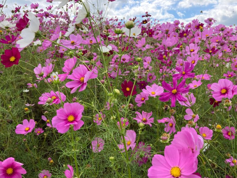
Photo: Helen Fields, obviously